Trip 1957 - Rock Creek
Description:
In August 1957 Frank Moore and his family car camped at Rock Creek. Numerous day trips provided the photo opportunities.
Maps:
Rock Creek itself is on the Mt. Tom 15' But upper Little Lakes Valley and most of the hikes are on the Mt. Abbot 15' map.
Photos:
|
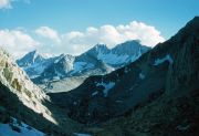
Bear Creek Spire, center, Hourglass Coulior and Mount Dade peak to right, unnamed pyramid 12866' to left. Seen from Rock Creek area. (image: 1957 362) |
|
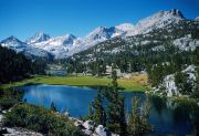
Little Lakes Valley. Looking south to Mount Dade center, and to left Hourglass Coulior, unnamed peak 13268', Bear Creek Spire and unnamed 12866'. (image: 1957 363) |
|
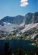
Long Lake in Little Lakes Valley and Bear Creek Spire. (image: 1957 369) |
|
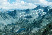
Bear Creek Spire northeastern drainage viewed from Mono Pass / Ruby Lake area. Long Lake. Chickenfoot Lake below Morgan Pass. (image: 1957 376) |
|
Mount Abbot, Mount Dade, snow filled bowl 12975' and Bear Creek Spire, seen to south from Mono Pass trail. (image: 1957 377) |
|
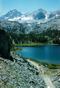
Ruby Lake from Mono Pass trail. (image: 1957 378) |
|
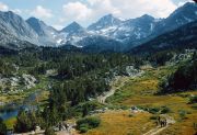
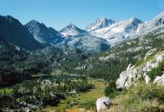
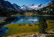
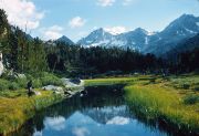
Little Lakes Valley, looking south from Mono Pass trail. (image: 1957 381) |
|
Little Lakes Valley, looking south. (image: 1957 382) |
|
Little Lakes Valley, looking south. (image: 1957 383) |