Trip 1944 - Palisade Lakes and Bench Lake
Description:
In August 1944 Frank Moore and Horace Hinckley took a fairly long trip over Bishop and Mather Passes, to Dusy Basin, Palisade Creek and Upper Basin.
They started from Parchers Camp on the South Fork of Bishop Creek, where they rented a pack mule. Their route proceeded past South Lake and Long Lake to Bishop Pass, down Dusy, up the Middle Fork of Kings River, up Palisade Creek past Deer Meadow and the Palisade Lakes, up across Mather Pass, and dropped down through the Upper Basin of the South Fork of the Kings River, and across to Bench lake. Presumably they returned by the same route.
The photos were taken both out and back, but are rearranged here as if taken one way.
Maps:
The first portion of the trip from South Lake up Bishop Pass and around to Deer Meadow is on the Mt. Goddard 15' Quad. The Palisade Lakes, Mather Pass and Upper Basin stretch are on the Big Pine 15' Quad, and Bench Lake is on the Mt. Pinchot 15' Quad.
Photos:
|
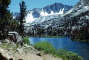
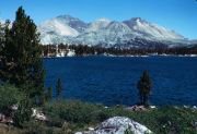
Mount Goode, seen south across Long Lake. (image: 1944 075) |
|
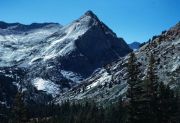
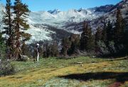
Langille Peak, west from Dusy trail. (image: 1944 081) |
|
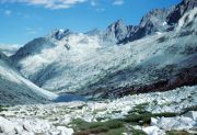
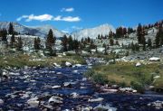
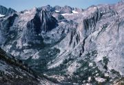
The Palisades and Palisade Lake, looking north from Mather Pass trail. (image: 1944 085) |
|
The Palisades and Palisade Lake, looking north from Mather Pass. (image: 1944 086) |
|
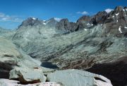
Upper Basin of the South Fork of Kings River, looking north to Mather Pass. (image: 1944 087) |
|
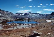
Cardinal Mountain, northeast across Bench Lake. (image: 1944 088) |
|
Upper Basin of the South Fork of Kings River, seen north from a few miles downstream. Mather Pass with Disappointment Peak and The Palisades behind to left. Mount Bolton Brown to right. (image: 1944 091) |
|
Upper Basin of the South Fork of Kings River, looking south. Mount Ickes in the center. Pyramid Peak towards far right, and Mount Ruskin at the photo edge. To the left Crater Mountain, the approach to Pinchot Pass, and a shoulder of Mount Pinchot. (image: 1944 092) |
|
The Citadel across Le Conte Canyon, seen from Dusy trail. (image: 1944 096) |