Trip 1947 - Evolution Valley and Piute Canyon
Description:
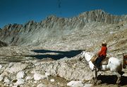
In August 1947 Frank and his wife took a longer trip via Muir Pass through the Evolution Valley. The photographic and written records do not indicate the details of the start and end of the trip. Most likely they started from South Lake on the Bishop Creek road, and had to transfer around on the return. They rented one riding horse and one pack horse.
The photographic records starts at Muir Pass. They descended through Evolution Basin to Evolution Valley and down river to the junction of Piute Creek. Then they ascended Piute Canyon, took a side trip up French Canyon, and they came out through Humphreys Basin and Piute Pass.
Maps:
The entire trip can be followed on the Mt. Goddard 30' Quad. The earlier part of the trip is on Mt. Goddard 15' and Blackcap Mtn. 15'. The later part is on the Mt. Abbot 15' and Mt. Tom 15', and back to the Mt. Goddard 15'.
Photos:

|
Mount Powell, north across Helen Lake. (image: 1947 220) |
|
Mount McGee from Muir Pass, northwest across Wanda Lake. (image: 1947 224) |

|
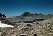
Black Giant, Muir Pass and Mount Solomons, southeast from Wanda Lake. (image: 1947 225) |
|
Mount Mendel and Mount Darwin, north-northeast from Wanda Lake outlet. Mount Spencer below Darwin. (image: 1947 226) |

|
Mount Huxley from Sapphire Lake. (image: 1947 232) |
|
Goddard Divide, south from Evolution Lake. (image: 1947 227) |
|
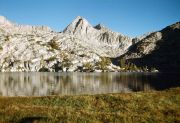
Mount Spencer south across Evolution Lake, with Mount Fiske behind. (image: 1947 228) |
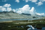
|
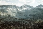
Evolution Valley, from below Evolution Lake. (image: 1947 231) |
|
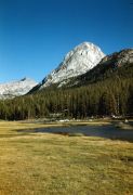
Mount Mendel, seen east from McClure Meadow to McGee Creek trail. (image: 1947 233) |

|
Mount McGee, seen up McGee Canyon. (image: 1947 234) |
|
McGee Creek. To the northeast, peak 12722' north of Darwin Canyon and peak 13404' northwest of Mount Lamarck. On right, peak 13385' behind shoulder of The Hermit. (image: 1947 235) |

|
Mount McGee, from upper McGee Creek. (image: 1947 236) |
|
Mount Mendel, seen from McClure Meadow, with Mounts Haeckel, Wallace and Spencer in distance. (image: 1947 237) |
|
The Hermit, from McClure Meadow. Mount Fiske in distance. (image: 1947 238) |
|
Evolution Creek at McClure Meadow. (image: 1947 240) |
|
Mount Mendel and Mount Darwin from McClure Meadow. (image: 1947 242) |
|
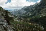
Goddard Canyon, looking toward Red Mountain from switchbacks up to Evolution. (image: 1947 243) |
|
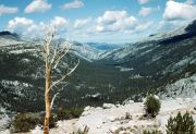
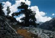
Juniper tree and cumulus clouds at Goddard Canyon. (image: 1947 244) |
|
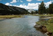
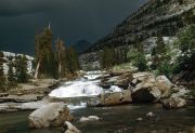
Piute Creek falls, a little north of confluence with South Fork of San Joaquin. (image: 1947 247) |

|
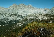
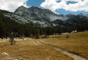
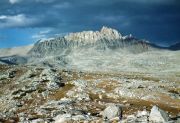
Merriam Peak, seen north from lower French Canyon meadow. (image: 1947 248) |

|
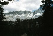
Glacier Divide, seen south from lower French Canyon. (image: 1947 249) |

|
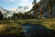
Upper French Canyon. (image: 1947 250) |
|
Peak 12432' silhouette, from lower French Canyon meadow campsite described in Starr's Guide. (image: 1947 252) |
|
Glacier Divide above Packsaddle Lake, seen from upper Piute Canyon. (image: 1947 254) |
|
Glacier Divide above Packsaddle Lake, seen from Piute Creek trail east of Hutchinson Meadow. (image: 1947 255) |
|
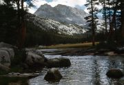
Mount Humphrey, seen across Humphreys Basin from Piute Pass trail. (image: 1947 256) |
|
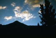
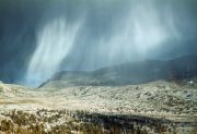
Rain curtain over Piute. (image: 1947 258) |
|
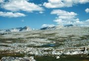
Humphreys Basin desolation. (image: 1947 264) |
|
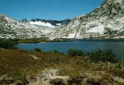
Summit Lake below Piute Pass, looking southwest. (image: 1947 265) |